
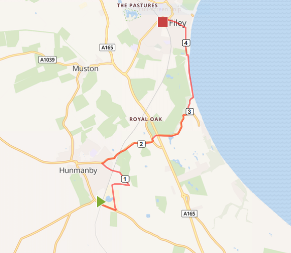
Map of Hunmanby Railway Station to Filey Railway Station via Primrose Valley Beach. The numbers show the miles from Hunmanby Railway Station.
This link to the Map o Meter page for the Hunmanby Railway Station to Filey Railway Station via Primrose Valley Beach will show the map in full size, calories burnt, and gradient profile.
This route starts at the village railway station, it gives the option of returning by train, or choosing one of the other walking routes back to Hunmanby to make a longer circular walk.
In the information racks on the Scarborough Platform (Number 2) there are leaflets for the Hunmanby in Bloom flower trail and the Hunmanby History Group 'Heritage trail'. Both have maps and describe the history of the village and location of the flower beds and open spaces maintained by the village community.
Turning left out of the station the new signs installed by Scarborough Borough Council point the way out of the village along Bridlington Road towards the Industrial Estate. Climb the hill past the early industrial history of Hunmanby. The sign pointing to 'Fishing' is the fishing lake formed in the old clay pits.
Walk past the tyre factory and at the new road that forms the modern Industrial Estate Access Road turn left. This ends with a barrier, go round, on your left is Hunmanby Crown Green Bowling Club, to your right Hunmanby Playing Fields Association Club House. On reaching Sands Lane turn right. The Piebald Inn opposite was formerly the Railway Tavern and opposite the old North Eastern Railway Coal Yard.
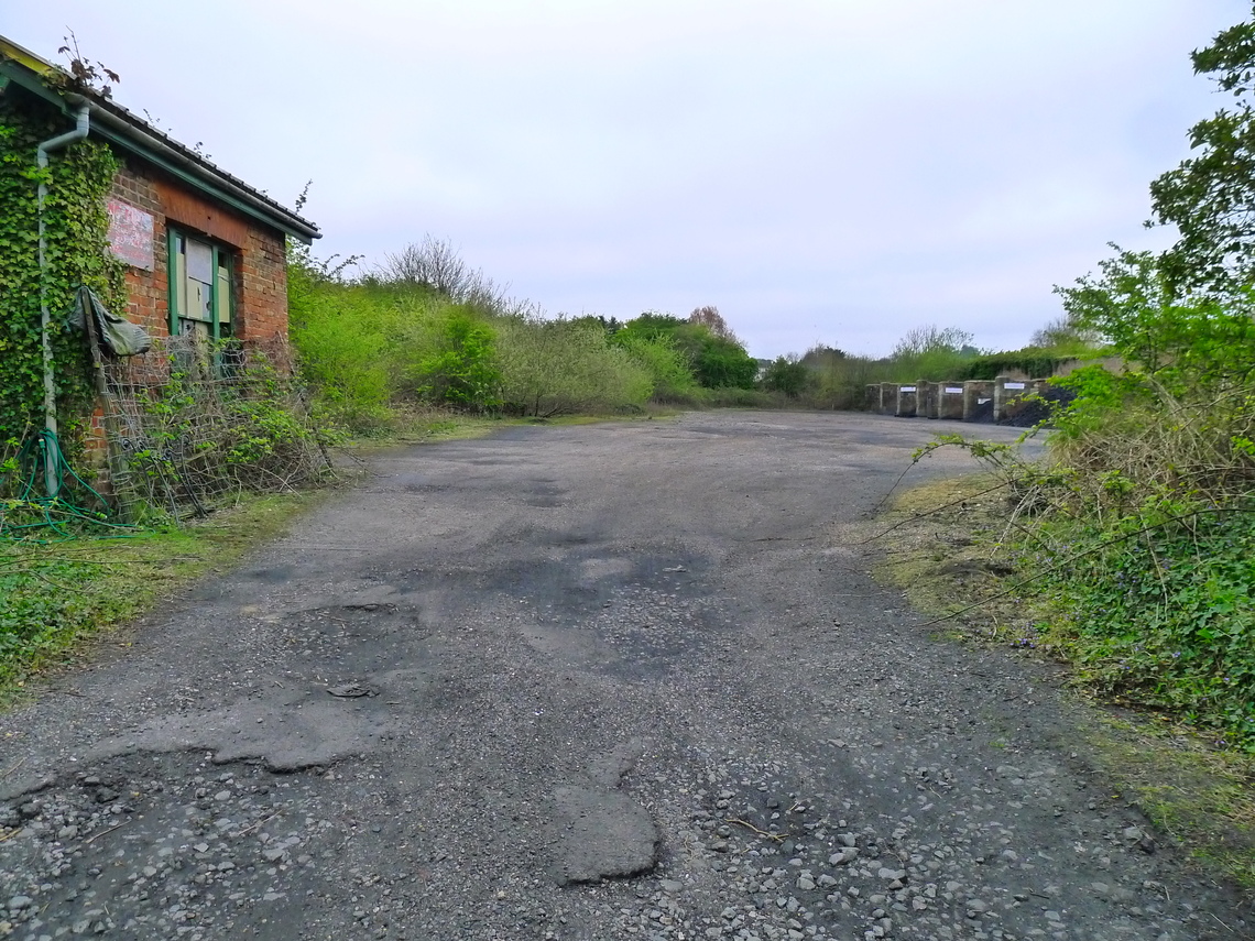
Photo above: The former coal yard and coal drops of the North Eastern Railway, Sands Lane crossing (formerly Depot Lane) Hunmanby
At the road junction with Sheep Dyke Lane turn left. This sign track road, with sheep usually grazing in the fields on both sides of the road takes you back under the railway line by way of a bridge will with its original cast-iron facing girder and parapet from the 1840's.
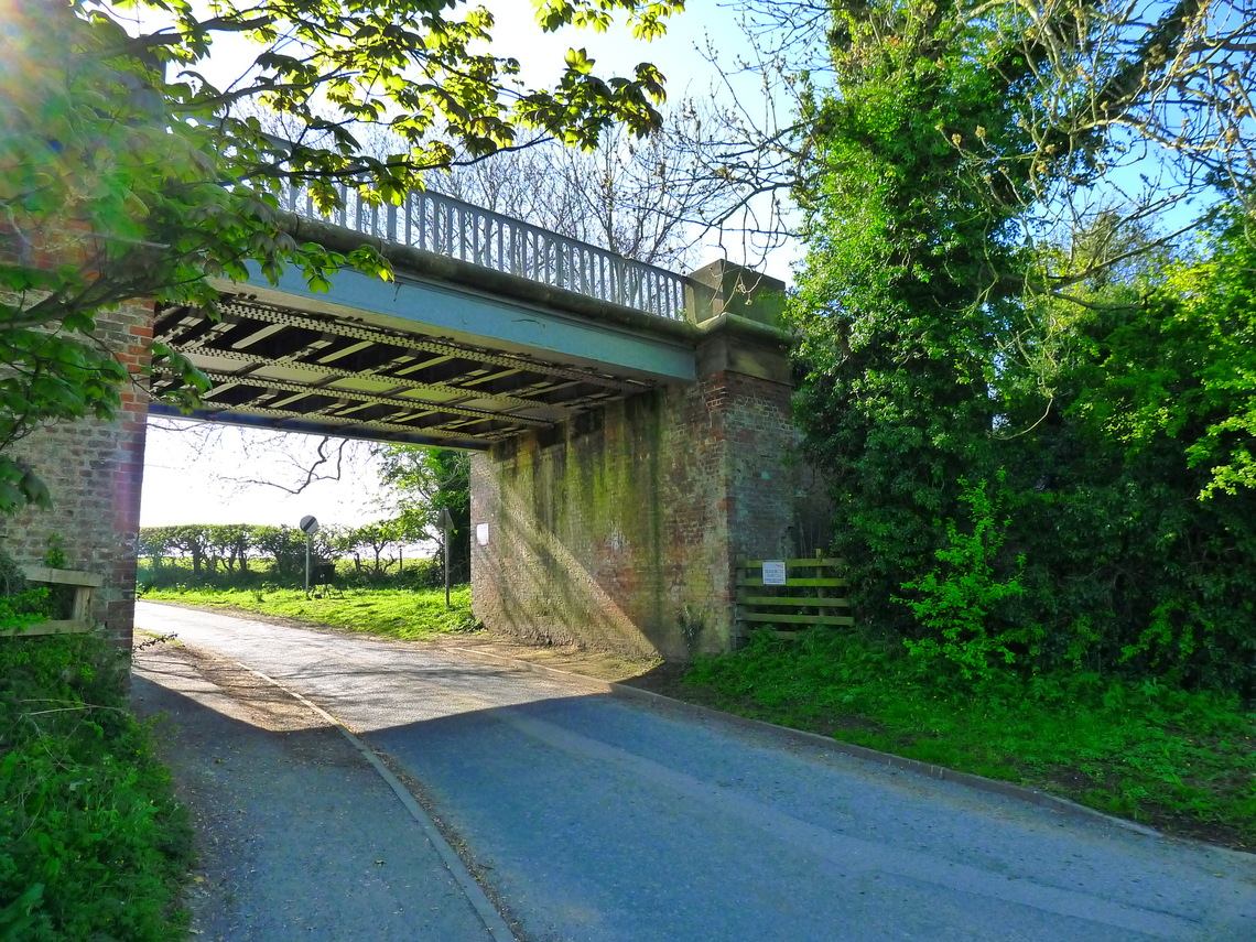
Photo above: Sheep Dyke Lane railway bridge
The junction of Hamerton Close and Sheep Dyke Lane marks the spot of the sheep dip. Though for many years the river Hertford has been culverted through the village. Approaching the junction with Stonegate, opposite Pinfold Lodge, is the well maintained public open space, looked after by Hunmanby Parish Council Caretakers. Here is the Pinfold (There are a couple of sheep inside!) and the former Village Lock up, dating back to the days of early policing.
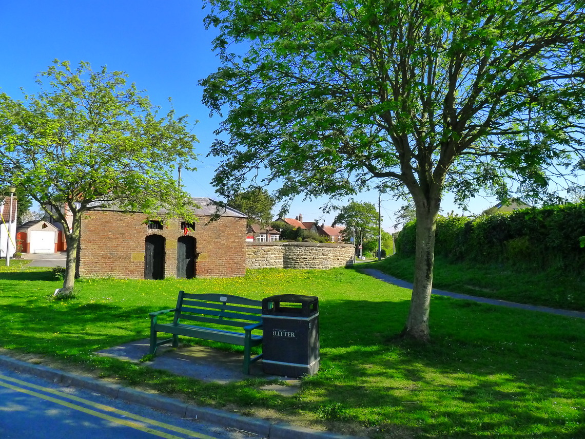
Photo above: The Pinfold and lockup
At the Junction with Stonegate turn right. You pass Orchard Farm holiday village, and after going under the railway bridge, the route is now called Filey Road. The abutment on the left hand side of the road is from the railway of the old Filey Holiday camp branch line.
Meeting a road junction, the former route of the main coast road, cross this and head towards Primrose Valley garage with Spa Shop, handy for supplies. At the junction with the 'newer' coast road, cross this and walk down Primrose Valley Road, past the lake with the geese and wild foul on your right and Filey Golf Course to the left. At the public open space bear to your left on the main route. When you see the Primrose Diner Cafe, turn left. The road continues to a barrier. Walk round this and down the tarmacked footpath to Primrose Valley Beach.
It is then just over a mile walk to Filey along the beach, if the tide is out (the alternative route if the tide is in is along the cliff top path)
When you reach the path down Martin's Ravine at Filey there are toilets, Cafes and Takeaways on the sea front. So, walk up the ramp have a refreshment break, then take the footpath at the side of the Martin's Ravine, you can choose a network of paths through Crescent Gardens which are well maintained by Scarborough Borough Council, Filey in Bloom and Friends of Filey Parks. Further details from Filey in Bloom Facebook page and Friends of Filey Parks Facebook Page The walk passes the band stand, full details of concerts from Filey Town Council Band Stand Webpage. Then walk around the rear of the Evron Centre and up Murray Street, Station Avenue, past the bus station with public toilets and up Station Approach to the Grade II* listed Filey railway station. Further details of the history of the station from the Wikipedia Filey Railway Station webpage
This link gives you details of current train departures from Northern Rail at Filey railway station. So giving the option of walking back to Hunmanby by a different route or catching the train to Hunmanby from Platform 1 (this platform has the ticket machine as Filey station is unstaffed.
Updated 18.10.2021