Local press coverage of flood risk statement, April 2016
Follow up letter from Alison Fure, 15/04/16
Links to some useful Kingston Council documents below; we have also saved some useful documents that are hard to find on the Council website on the KEF website:
- RBK on Reducing flood risk in new developments - https://www.kingston.gov.uk/info/200283/flooding_and_drainage/528/managing_development_and_building_works/7
- RBK Best Practice Case Studies
- RBK Strategic Flood Risk Assessment, 2011
- Local Flood Risk Management Strategy, approved 10 December 2015, including
the action plan of how and when the strategy is to be reviewedthe Local Flood Risk Management Strategya borough map showing watercourses (2014)a borough map showing an overview of surface water flood risk (2014)a borough map showing the flood risk from main rivers (2014)a borough map showing the flood risk from groundwater (2014)a borough map showing historic flood incidents (2014) - 2008 Jacobs flood risk assessment report -https://www.kingston.gov.uk/downloads/file/1925/strategic_flood_risk_assessment_-_royal_borough_of_kingston_upon_thames_level_1_2008
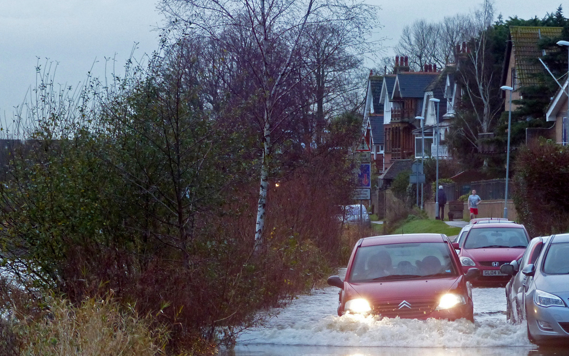
Tidal flooding on Lower Ham Road, Kingston, January 2016
Photo by Charles Roscorla
See also
1/6/17, The Guardian reports a study that finds "Nine tenths of England's floodplains not fit for purpose." https://www.theguardian.com/environment/2017/jun/01/englands-90-floodplains-not-fit-for-purpose-study-finds
In March 2017 Thames Water was fined a record £20m after pumping 1.9 billion litres of untreated sewage into the River Thames in Buckinghamshire and Oxfordshire in 2013 and 2014 - see BBC News at http://www.bbc.co.uk/news/uk-england-39352755
Info and news on the Environment Agency’s River Thames Scheme at https://www.gov.uk/government/collections/river-thames-scheme
"Natural ways of stopping floods, such as tree planting and putting logs in rivers to slow water flow must be a key part of protecting the nation as climate change intensifies rain storms, according to a report from MPs." The Guardian, 2/11/16
A collection of articles and news on flooding in the Environment section of The Guardian
"Britain's roads, bridges, railways, hospitals, electricity, gas, water and internet remain at risk from floods" Govenment review published July 2016 - see BBC news
"The great tide: is Britain really equipped to cope with global warming? As the Earth’s temperature continues to rise at an alarming rate, the country faces the threat of catastrophic flooding..." Simon Parkin in The Guardian, 7/7/16
A flooded London below, as imagined in The Guardian, 7/7/16
BlueGreenCities Delivering and Evaluating Multiple Flood Risk Benefits in Blue-Green Cities "A Blue-Green City aims to recreate a naturally-oriented water cycle while contributing to the amenity of the city by bringing water management and green infrastructure together..."
MPs criticise government over flood protection plans, BBC news, 6/9/16
Environment Agency, 2016 - River Thames Scheme: reducing flood risk from Datchet to Teddington - https://www.gov.uk/government/publications/river-thames-scheme-reducing-flood-risk-from-datchet-to-teddington/river-thames-scheme-reducing-flood-risk-from-datchet-to-teddington
The London Waterkeeper - http://londonwaterkeeper.org.uk/ - campaigning for cleaner rivers, including “A Thames Fit To Swim In”. See their data on Pollution in the Hogsmill at http://e-voice.org.uk/kef/assets/images/pollution-in-the-hogsmill
Check your property is connected right. If wastewater or sewage is connected to a surface water drain you may be polluting your local river or beach - http://www.connectright.org.uk/
LWT's guide to working with nature to make your neighbourhood more flood-proof http://www.wildlondon.org.uk/news/2014/12/15/living-rainwater-londoners-taking-simple-steps-reduce-flood-risk
Dead fish in Hogsmill river


