Where did it all begin?
If you look at many villages they are built to a set pattern. Our neighbour, Churchtown is built around its Church, Wray Green is built around a wide open space - the Green. Even St Michaels has a set pattern being Medieval but built around its Church. Other villages like Lees, near Oldham are built around a distinct area known as The Square, bounded by the Police Station, Church and a farm. Some are built around the Big House. But what og Great Eccleston?
It has no gree, the Church is about a mile away, even the earlier Roman Catholic Church is not in the centre. It does have a 'Big House' but that is modern in relation to the origins of the village. It has a Square - no it does not, it has a bulge in the road.
The layout of the village is Medieval and is built along a road, West End, High St, and Raikes Road. Raikes Road we know used to be a dirt track in fact Raikes means path. So what of the bulge? why is it there? First of all the 'Square ia only on one side of the road and is not distinct enough to be a Square. It is my belief that the layout was built along the road but the centre of the village was known to have fairs and markets therefore an area needed to be set aside for this - this became the 'Square'. Therefore we can ascertain that the fair / market was held in pretty much the same place as nowadays, in an area bounded by Chapel Street; and the old Police Station in West End.
Great Eccleston is an ancient village and existed long before Domesday, the earliest known information is 1066. At this the village was large village, much larger than surrounding villages therefore it was included in Domesday. If you search Domesday then you will find that it is in Yorkshire as Lancashire did not exist.
In 1066, it was part of the ancient hundred of Amounderness and was owned by Tostig Godwinson, the brother of King Harold II. This means that the village must have existed before this time.
In 1069 in the tax rolls the size of the village was two carucates (ploughshares) The carucate was a medieval unit of land area approximating the land a plough team of eight oxen could till in a single annual season. However the village recorded no households. The village lord of the manor was Earl Tosti in 1066, with the landowner being William thr Conqueror. However in 1066 as Tostig had been killed at the Battle of Stamford Bridge and his lands were subsequently taken over by the Normans
Between 1069 and 1086 William the Conqueror gave Amounderness to Roger de Poitou, an Anglo-Norman baron.
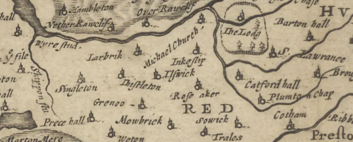
On a 1664 map of the area Great Eccleston is not shown but this is not due to to its size but to the fact that it did not have a church as other villages must have done.
On the 1659 map - Great Eccleston is still not listed, this shows the Church of St Anne was not yet built.
Just outside the village about half a mile from the 'square' on the southern side is Copp. The Old English name of Copp means summit ie land on the top of a hill. Copp is a cluster of farms and houses on the summit of a small hill.
Domesday
in 1066 Lancashire did not exist as a county therefore Domesday places the village in yorkshire and lists it as: Eglestun. The village was recorded as having 0 households.
As you can see from this copy of the listing it also lists two other names for the village.
There is a lot of debate about the name Eccleston. One account is that the land was orginally owned by Egil who was a Norse landowner. Many believe that it meant Church land but as mentioned previously there were no churches in the village up to at least 1664. I doubt it was church land for this reason and the fact that it was called Egilstun in 1086, the land of Egil. However at the time of Domesday it was recorded to have had three chapels.
Population in 1600s
There were 42 houses in the village in 1664.
Victorian Village
In 1871, John Marius Wilson's Imperial Gazetteer of England and Wales described Great Eccleston like this:
ECCLESTON (Great), a township in St. Michael-on-Wyre parish, Lancashire; on the river Wyre, 5½ miles SW of Garstang. It has a post office under Garstang. Acres, 1, 412. Real property, £3, 637. Pop., 641. Houses, 141. There are chapels for Wesleyans and Roman Catholics.
Notice the omission of St Anne's at Copp. Copp at this time was not part of the village.
In 1887 it had a population of 628 - so a large village even then. In the 2011 census the population of the village was 1473, in 2024 this had risen to 1657 inhabitants. with new houses planned this could rise even further in the next few years.
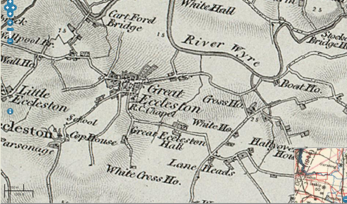
This shows the 1856 Map of the area. Many of the names will be familiar to you.


