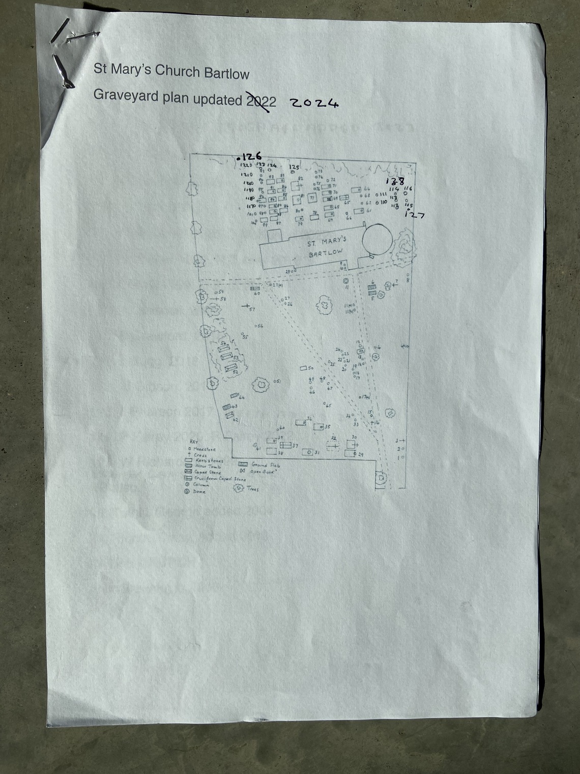
St Mary's Churchyard Map & Grave Index updated 2022

The map of St. Mary's churchyard and index of the graves was compiled by an enthusiastic and very competent local historian, Alan Bulwinkle, who did it on behalf of the Cambridgeshire Family History Society sometime around 1988.  It was discovered in the Cambridgeshire County Archive at Ely. 

Gilly Cunningham

Updated in 2022 by Duncan Ogilvy. See below


St Mary’s Church Bartlow

Graveyard plan updated 2022 

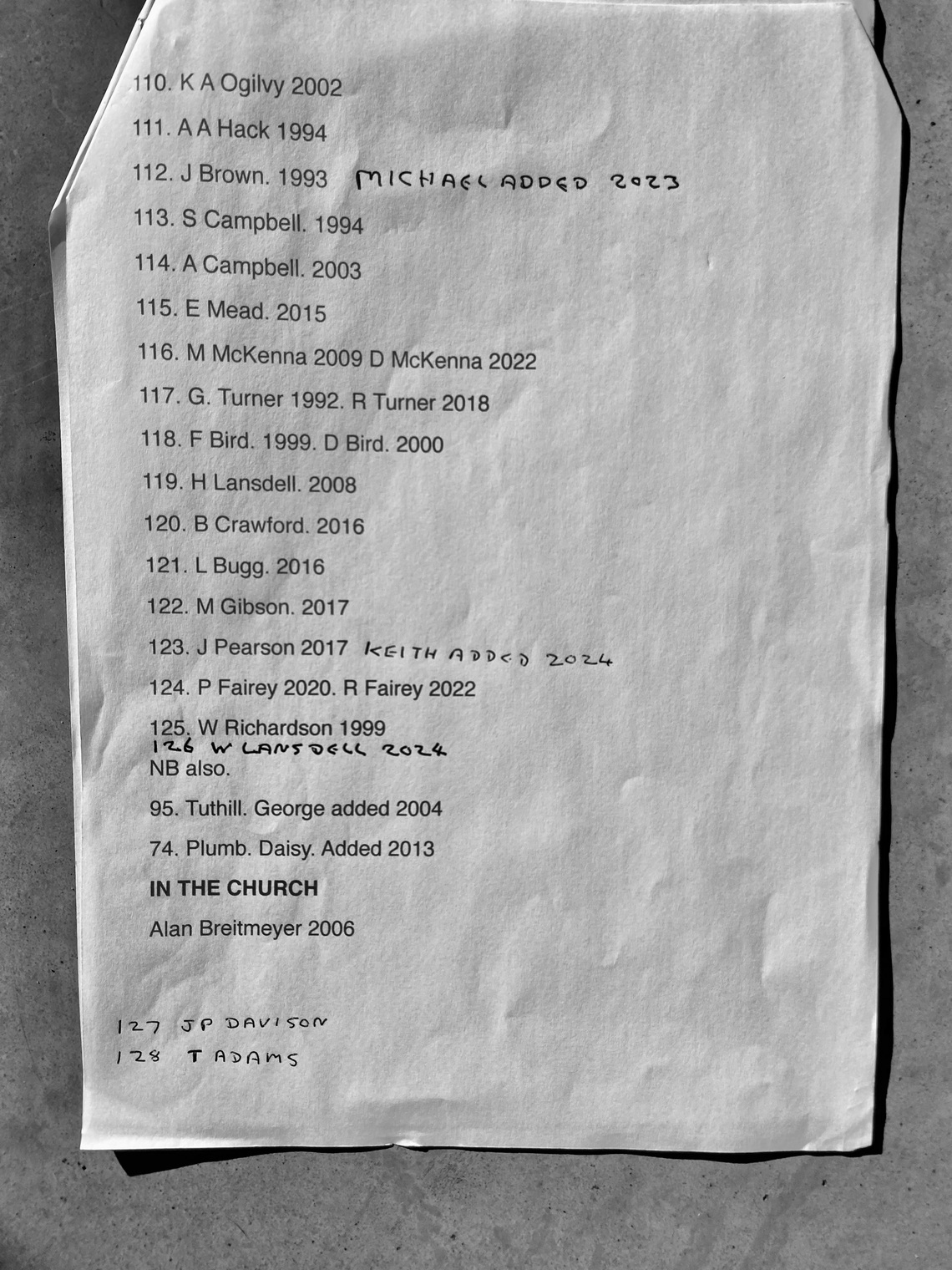
110. K A Ogilvy 2002

111. A A Hack 1994

112. J Brown. 1993

113. S Campbell. 1994

114. A Campbell. 2003

115. E Mead. 2015

116. M McKenna 2009 D McKenna 2022

117. G. Turner 1992. R Turner 2018

118. F Bird. 1999. D Bird. 2000

119. H Lansdell. 2008

120. B Crawford. 2016

121. L Bugg. 2016

122. M Gibson. 2017

123. J Pearson 2017

124. P Fairey 2020. R Fairey 2022

125. W Richardson 1999

NB also.

95. Tuthill. George added 2004

74. Plumb. Daisy. Added 2013

IN THE CHURCH

Alan Breitmeyer 2006