Menu:
- Local Plan Part 2 - Development at Dunsfold Aerodrome and elsewhere in Waverley
- Local Plan Part 2 - housing site allocations in Elstead
- Interactive map with Elstead sites and notes
- Elstead new settlement boundary
- Elstead housing sites. Where should new homes be built?
- Waverley Local Plan Part 1
Waverley Local Plan Part 2 - Housing Site Allocations [LINK]
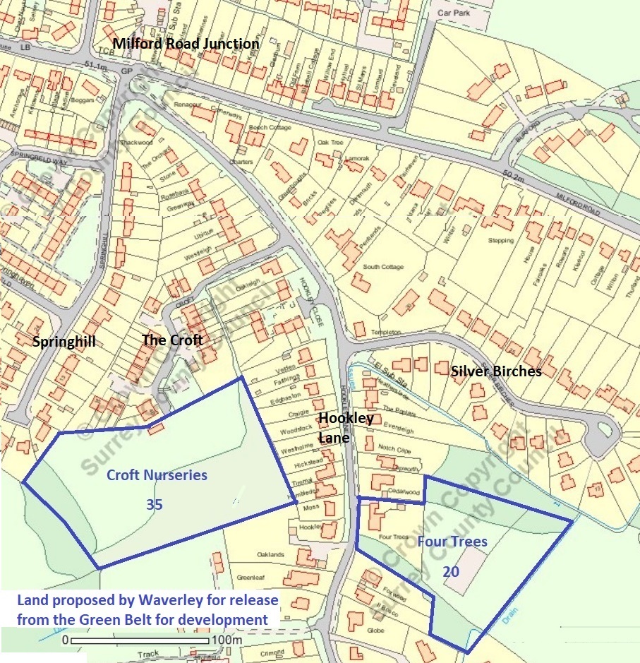
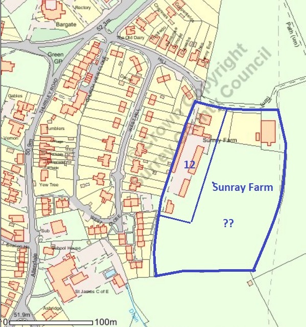
In Part 2 of the Waverley Local Plan three sites in the Green Belt adjacent to the Elstead Settlement Boundary have been proposed for new housing. Two of them, a field behind Four Trees and another behind The Croft, both off Hookley Lane, have been recommended for removal from the Green Belt. The third at Sunray Farm, off West Hill, is considered to be partly developed and new homes would be allowed to replace existing buildings and pre-developed land.
There is an interactive map showing the sites and explanatory notes here [LINK]
This downloadable document contains extracts from the The Waverley Local Plan Part 2 Consultation documents, with more details about the three sites and the revised Settlement Boundary.
New Settlement Boundary & land to be released from the Green Belt for development. [LINK]
Elstead Housing sites. Where should new homes be built?
The Waverley Local Plan exhibition in Elstead on Monday June 4th displayed a lot of information about Part 2 of the new Local Plan.
A major item for discussion was how many new homes should be built on each of the three Green Belt sites proposed by Waverley. They are Sunray Farm off West Hill (12), a field behind The Croft (35) and another behind Four Trees (20), both off Hookley Lane.
Click on the map for details of the Waverley site allocations.
The Hookley Lane sites would be released from the Green Belt.
Hookley lane residents are very reasonably concerned that developing two Hookley Lane sites will cause traffic problems at the Milford Road junction and along the narrow lane itself. Both sites are remote from the school, shops, bus routes and other village facilities.
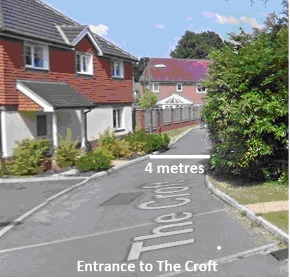
Residents of the Croft estate will be faced with more than doubling of the total number of homes using the very narrow and bendy service road off Hookley Lane, with no footway. In one place it is only a single vehicle width on a blind bend. This will cause chaos during development as well as congestion once the new homes are built.
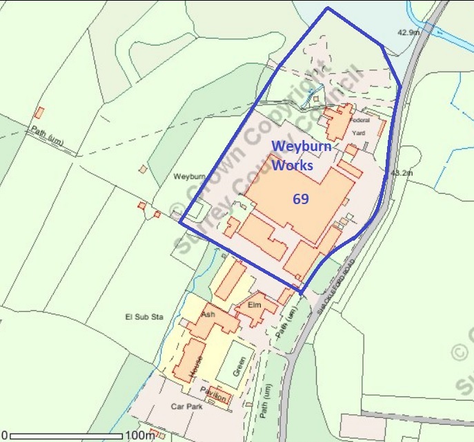
The Neighbourhood Plan team has recommended that more homes should be built on Sunray Farm, with none at Four Trees. Their main reasons are that Sunray Farm is much closer to village shops and facilities and development should not be all at one end of the village. Including 69 at Weyburn there would be 124 at the Milford end.
Waverley Borough Council has rejected a recommendation from the Neighbourhood Plan team that Sunray Farm should be released from the Green Belt, as it would intrude into the hilly area in the centre of the village. They are prepared to consider planning applications for up to 12 new homes to replace the existing buildings on the site.
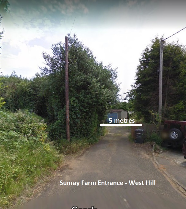
Sunray Farm also has narrow access at the entrance from West Hill. This can be improved by using part of the footpath that leads up the hill to provide a footway into the site.
Two possible ways of using the sites are:
1. The Waverley proposal: Croft 35, Four Trees 20, Sunray Farm 12. (more than the 59 needed).
2. The Neighbourhood Plan recommendation: Croft 28, Four Trees 0, Sunray Farm 31.
There are other possible permutations that could reduce the concerns of both Hookley Lane and Croft residents, while following the recommendation of the Neighbourhood Plan team. Wherever new homes are built will have an impact on traffic in the village but housing on Sunray Farm would have the least impact because of its central position.
Information on Waverley Local Plan Part 1 and other Planning documents can be found here:
Planning Information page on this site [LINK].
This downloadable document contains extracts from the The Waverley Local Plan Part 2 Consultation documents, with more details about the three sites.
New Settlement Boundary & land to be released from the Green Belt for development. [LINK]

