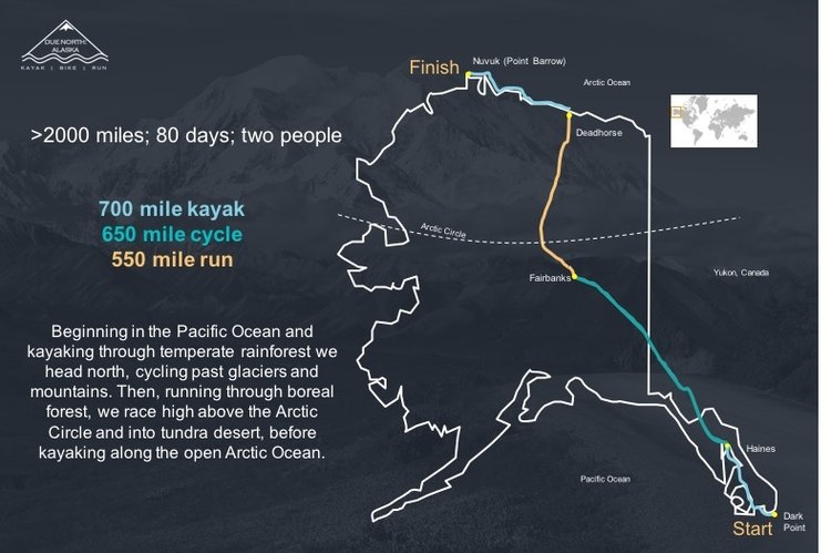
Objectives and Location: To traverse the entire length of Alaska using their own power, running, cycling or by kayak from south to north - see the map below.
Members: Hazel and Luke Robertson
Explorers in Residence at the Royal Scottish Geographical Society
Dates: Summer 2017
Web: www.duenorthalaska.com | hazelerobertson.com | lukerobertson
www.facebook.com/duenorthalaska - link not available
@hazelerobertson | @lukerobertson
@hazelerobertson | @lukejgrobertson
Linkedin: Luke Robertson
Trip summary
Our trip ended too soon.
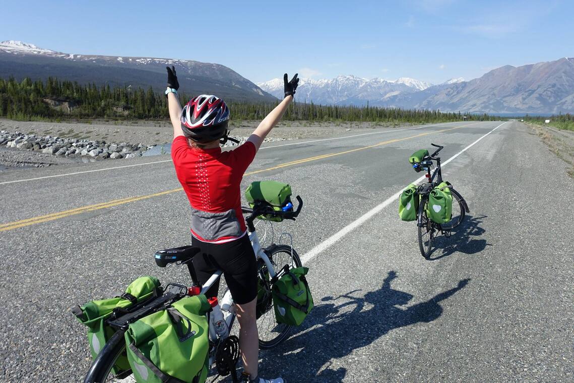
Over two and a half months we kayaked through remote temperate rainforest surrounded by a dramatic and spruce-packed mountain landscape, before paddling through as much of a contrast as you might find; the equally remote, but completely flat and tree-less expanse of land that surrounds the Arctic Ocean. Sandwiched in between, we cycled the full distance between these two bodies of water, briefly dipping into British Columbia and the Yukon of Canada along the way, witnessing receding glaciers and sprawling tundra around us. On two wheels, we covered over 1,300 miles, climbing over 40,000 ft., and took on the 415-mile infamous Dalton ‘Highway from hell’ dirt road along the way.
We encountered curious and confident sea lions and held our breath as majestic humpback whales breached intimidatingly close to our little kayak. We witnessed grizzly bears trawling the beaches for any form of sustenance at low tide and eagles soaring through thermals as we setup camp on beaches, islands, forest, tundra overlooking glaciers and laybys
However, it was in the far North, where we came across the biggest and scariest surprise of all.
After paddling carefully through sea ice at the start of our Arctic paddle, we headed inland, with the double benefit of pursuing a fascinating old Innupiat trading route and avoiding any further pack ice.
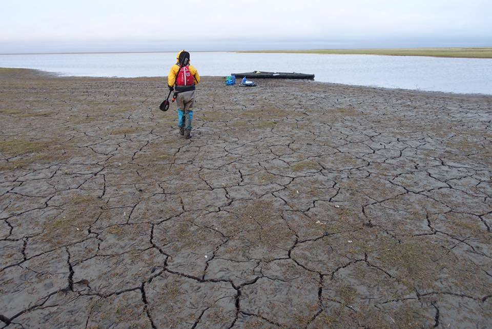
Almost immediately however, we were in trouble. Here, we found dry and grassy filled lake beds where once stood huge swathes of water; we trudged through mud instead of padding through water of any passable depth. Streams that once flowed suddenly stopped in their path and instead of water, the bow of our kayaks nudged up against grass and sand.
These were changes to the landscape that didn't appear on recent satellite imagery, certainly aren't on paper topographic maps and weren't known by anyone whose kind advice we sought for this particularly remote section of the expedition.
So, when we reached what would be the final lake of our expedition at 5am, after 30 hours of hauling and portaging 200 kg of gear over tundra and dry lake beds - only to find its water level as low as the rest and with similarly dangerous waist-deep sludge, we knew we could not continue. We camped up, both silent in the knowledge this would be the end of this expedition.
One of the main aims of the Due North: Alaska expedition is education through exploration. To share this journey with others - in all its ups, downs, twists, turns, landscapes and people - was a huge part of what drove us on each day when we were exhausted. It was what the trip was all about and we shouldn’t lose sight of that.
So, we'll continue to leverage what we've learned and share it as widely as we can. And all of the human-powered miles we did travel will be a success. Even if we didn't reach our final coordinates.
We wanted to see for ourselves and record evidence of a changing Arctic. Well, we saw it and struggled through it. It is engrained in our dry suits, our boots and our memories.
And so, although we found ourselves in a situation we had planned never to be in, we are beginning, bit by bit, to reframe success.
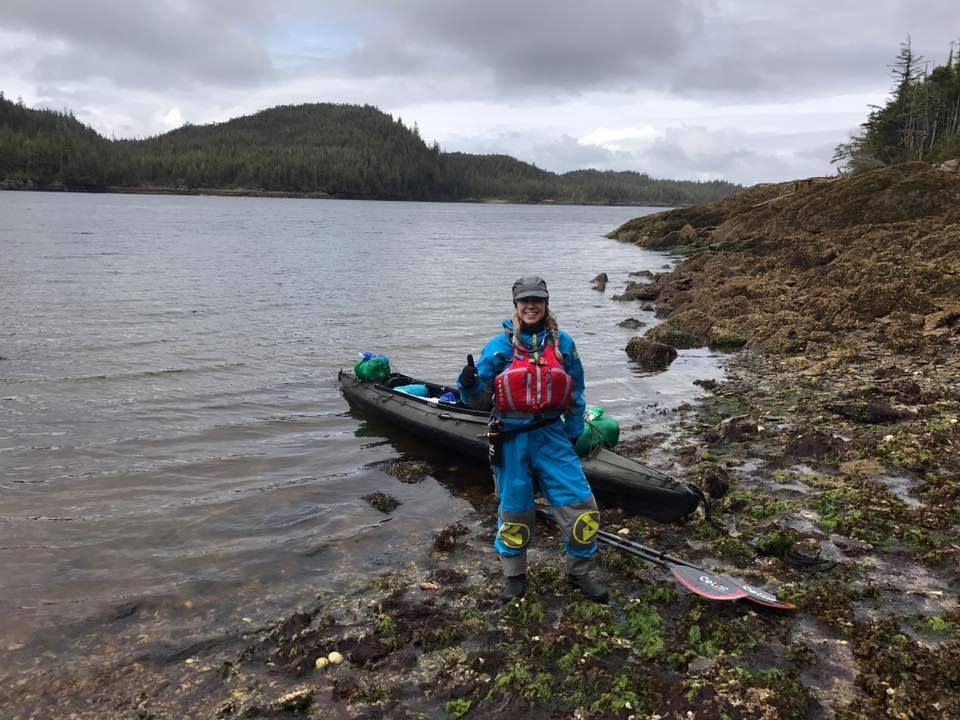
For many more photgraphs see @hazelerobertson | @lukejgrobertson
