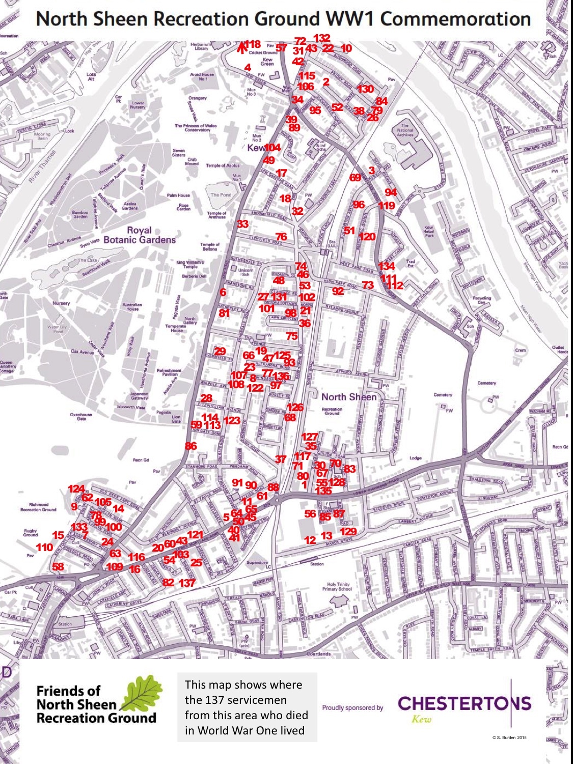
WW1 Commemorative Map in the café
In July 2015, the Friends of North Sheen Recreation Ground ran a Community Event that included a commemoration of the servicemen who lived around our Rec and lost their lives in the First world War.
We found details of 137 servicemen from this area who died in the First World War.
Please take some time to look at this material and remember the enormous sacrifice made on our behalf.
Key points to note are as follows:
The main sources for this material were the Richmond Borough War Memorial on Richmond riverside and the Darell School memorial, as well as The National Archives.
We have more information on some of the WW1 servicemen from our area who lost their lives and will post these details soon.
We hope to do further research on as many as possible of our local WW1 heroes. If you would like to help with this, please let us know via email: friendsnsr@gmail.com.
If you are related to any of these servicemen or have further information to share, please get in touch.
This document lists the names, service details and address of the 137 servicemen from our area who died in the First World War: List of WW1 heroes near NSRG
History of North Sheen Recreation Ground
Through his family, Hugh Leyborne Popham had been the owner of a large area of land in what was then North Sheen, measuring from North Road across to Pensford Avenue (and what is now Marksbury Avenue), and from High Park Road to Chilton Road. Much of this land had already been sold off for housing when on 15 July 1907 the "Mayor, Aldermen and Burgesses of the Borough of Richmond" paid the sum of £2,000 to purchase the area which now forms the southerly half of the Rec - the area coloured blue on the plan below. The land was sold subject to various restrictions and requirements, but the principal one was that the land should be used "as land for a Recreation Ground and for no other purpose".
On 17 September 1923 the land coloured red on the plan shown below was also acquired by Richmond Council, on this occasion for the sum of £1,884, 7s. 6d. The same restrictions on its use were imposed as on the earlier occasion. Included in the sale was the land which now forms the entrance from Marksbury Avenue, access having previously only been from the southern and western boundaries.
Finally, on 27 August 1991 the land which is now the fenced dog exercise area (coloured purple) was acquired by Richmond Council and, subsequently, that coloured yellow, so completing the Rec as we know it today.

