
THE NURSERYLANDS & NURSERY GREEN – A BRIEF HISTORY
From the late 1880s onwards a number of market gardens or nurseries began to appear on what had been farmland in the area of Tangley Park, particularly between Buckingham Rd and the Hanworth border. In 1890 the Villa Farm Company was liquidated and the Marling family took over and the area became known as Marling Park. The building of houses continued very gradually but the majority of the area became used as nurseries which was the next most profitable use after housing development.
Market gardening did not begin to flourish in Hampton until the 1880s. In 1884 there was only one nursery; by 1888 there were 12 and by 1900 there were 32, with about 600 glasshouses. There were still 45 nurseries in business by 1939, but the ever-growing demand for land for building, as well as competition from abroad, meant that what used to be Hampton’s main landmark was to disappear. By 1973 there were 8 nurseries.
The nurseries remained highly successful up to and including the Second World War and into the 1950s, but increasingly competition from Holland and the ability for suppliers to import produce by airfreight made them increasingly less profitable despite scientific innovation to improve yields and the building of much larger glasshouses. The nurserymen began to give up their businesses.
In October 1957 a planning application was made to develop the nurserylands, now part of London’s Green Belt, on the grounds that the land had ‘gone sour’. New Ideal Homesteads applied to build on behalf of the Triangle Growers Association, attempting to change the status of the Green Belt to residential land. The application was refused, as were applications in 1960, 1963 and 1966.
Hampton Residents’ Association (now Hampton Society), realising that change was imminent proposed the retention of open space and community uses. Several rural features including a green opposite All Saints’ Church (which is now called Nursery Green) were included and a plan to close Oak Avenue was prevented.
The building of what is now known as The Nurserylands began in the late 1970s.
John Sheaf
Notes:
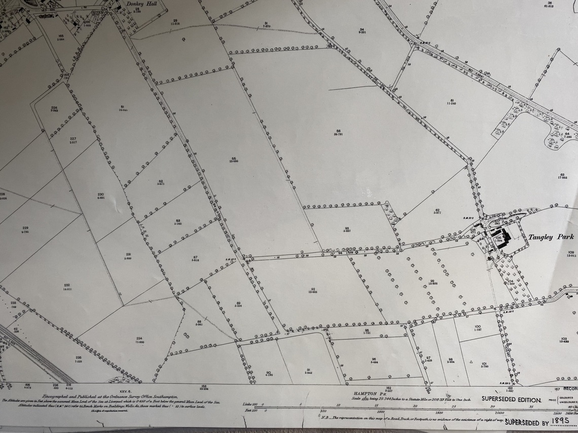
1863 OS map – Note Nursery Green was then part of plot of agricultural land marked with no “93”
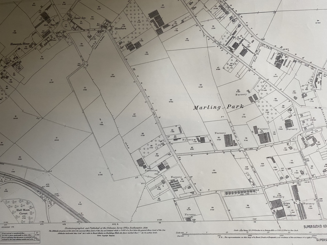
1894 OS map – Nursery Green had become part of a Nursery numbered “80”
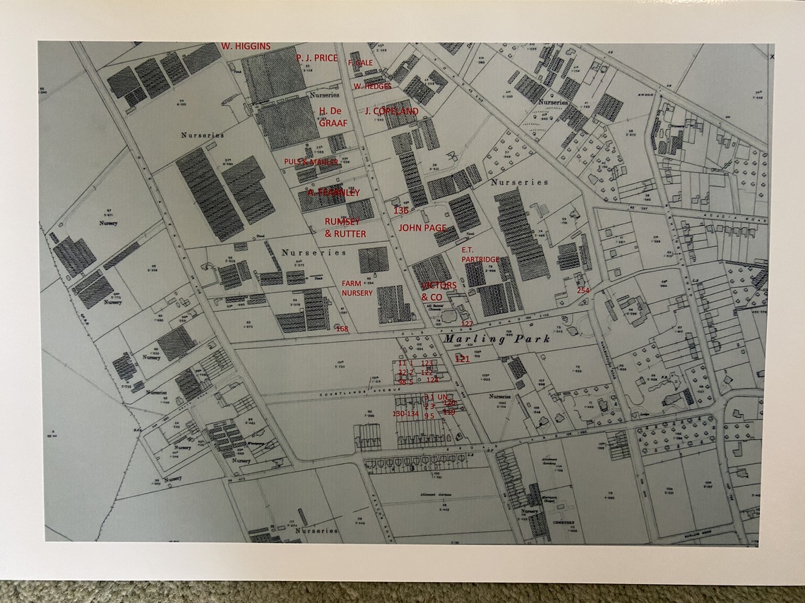
1912 OS map with occupiers as per 1911 Census. NB I have marked all the names, in The Avenue, on the map of the 1911 occupiers when “80” was known as “Farm Nursery”. Note also additional glass houses, from the previous map, and also All Saints Church has now been built.
1912 OS map – Another copy without all the names marked. Nursery Green part of “80”
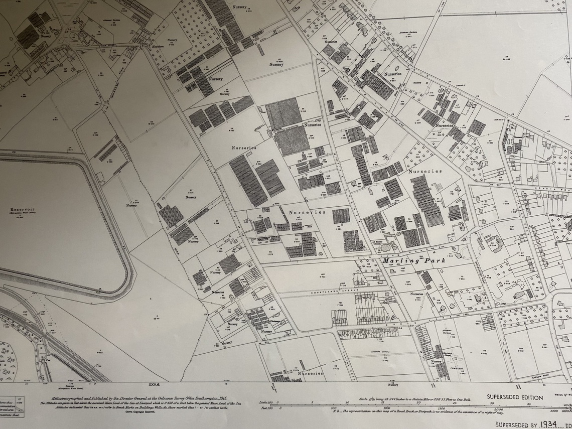
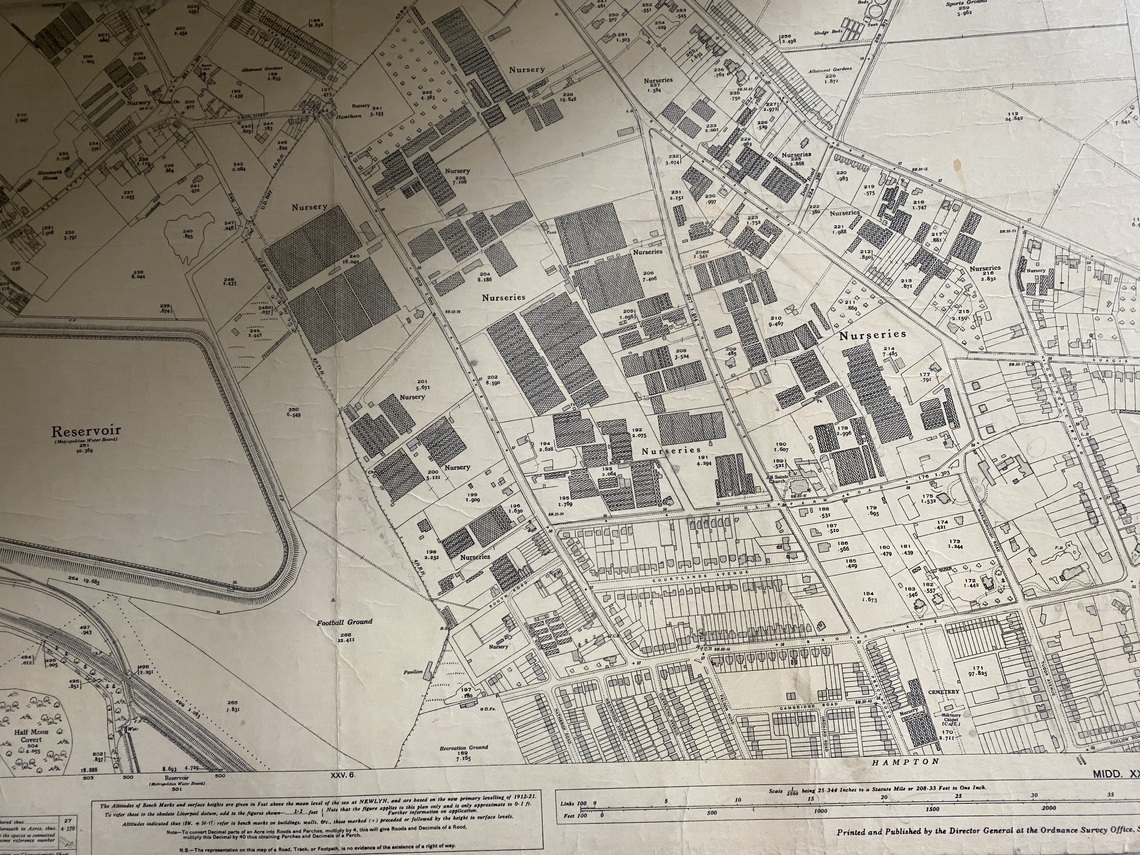
1934 OS map – Nursery Green has become part of “191”. Note also further glasshouses built since previous map
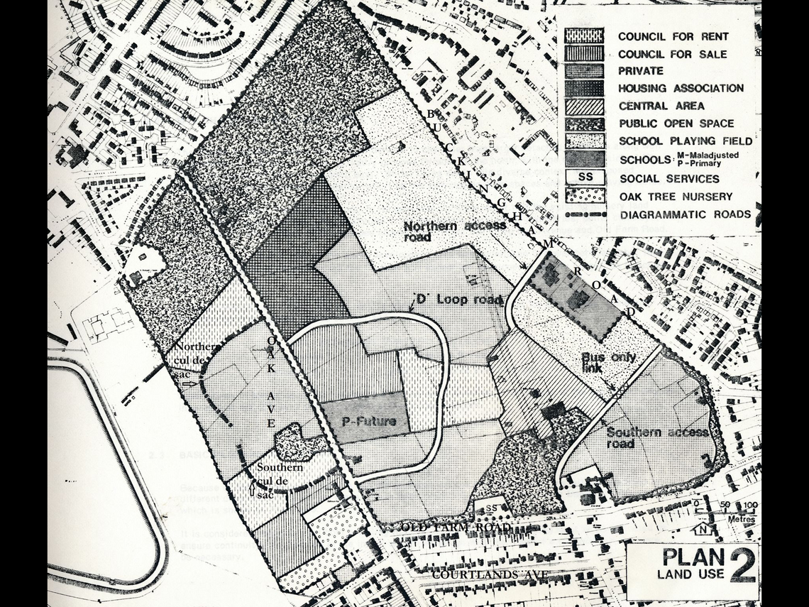
“Planned usage of Nurserylands” – This plan is of the original development plans. It is also of use because you can see the feint outline of the original line of The Avenue marked on it. (As you know the original line of The Avenue was changed to join Buckingham road much further south than it used to – so that the central area of The Nurserylands could be pedestrian only).
We are extremely grateful to John for the detailed history he has supplied for this page. John's books on Hampton can be obtained from the Borough of Twickenham Local History Society (BOTLHS) website (Publications) [All proceeds go to BOTLHS]). Other local information on Hampton and surrounding area can be found at www.twickenham-museum.org.uk/