The Higher and Lower Glen, Honiton – An Outline History
The part of The Glen nearest the town centre was developed as a public open space by Honiton Borough Council on land, part neglected water garden and part woodland, given by Major H. H. Lilley to commemorate the Silver Jubilee of King George V and Queen Mary in 1935. It was opened during Honiton’s celebrations for the Coronation of King George VI and Queen Elizabeth in 1937. Between the Jubilee and the Coronation there had been the death of King George V and the brief reign and then abdication of the uncrowned King Edward VIII. Ownership of that part of The Glen passed from the Borough Council to East Devon District Council in 1974.
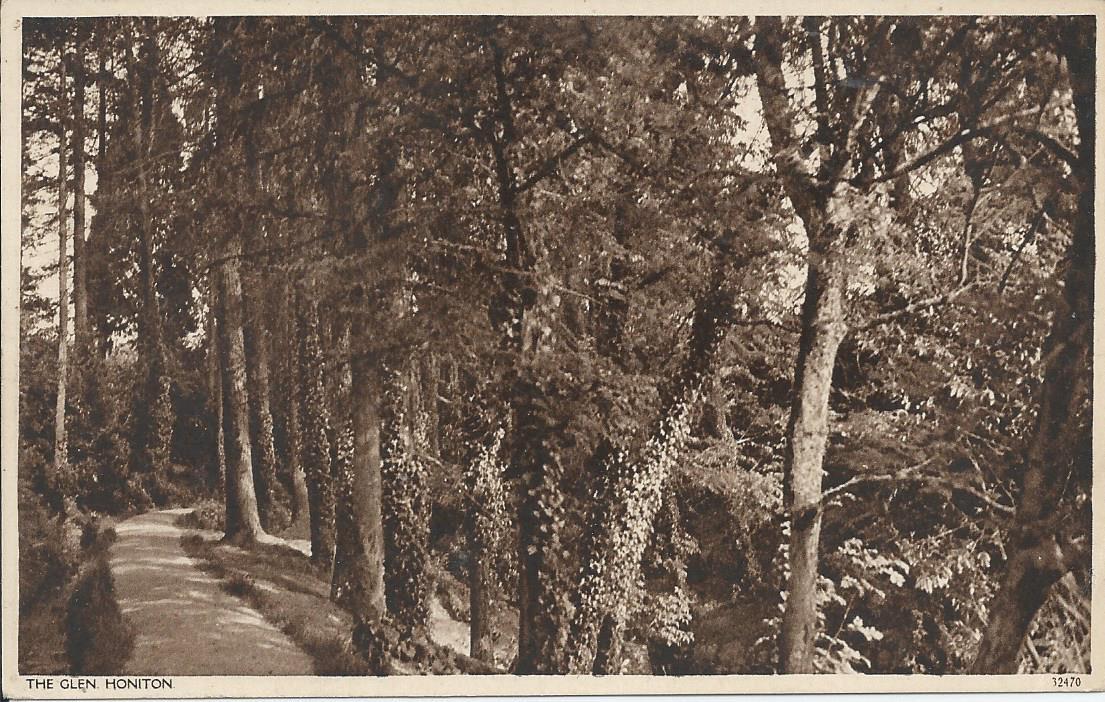
Dimonds Library picture postcard of the Lower Glen Leatside Path 1930's
Continuing upstream, the narrow steep sided valley remained neglected and was until 2010 encreasingly overgrown by a range of exotic and native trees and shrubs. From a road and the parallel public footpath it was just possible to see garden remnants and to hear the sound of the few surviving waterfalls. The history of the garden there, The Higher Glen, became more certain in January 2015: a Rector of Honiton had developed a similar water garden further upstream in a side valley by the 1840s when it was shown on the tithe map, so it is likely that the Rectory water garden could have been the inspiration for the water garden in The Higher Glen now understood to have been landscaped with paths, bridges and seats at a cost of several hundred pounds by the Ashley family who had probably purchased the Pine Park Estate in 1884.
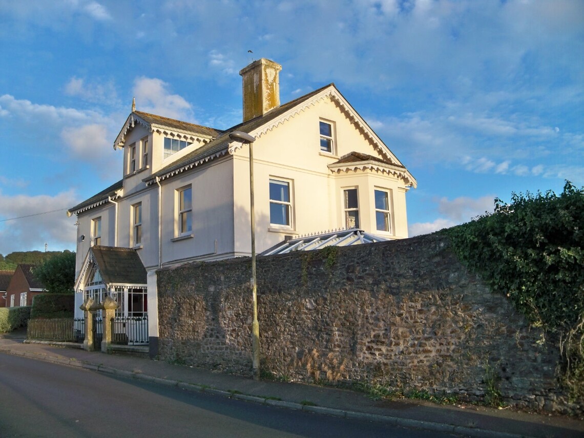
Pine Park September 2016
The 1903 Ordnance Survey map depicts several dams across the Glen Stream in The Higher Glen and picture postcards of views there have postmark dates from 1903 to 1911 inclusive; three images from Ilford lantern plates are of the same era and there are also three photographs from earlier, possibly from the late 1880's, but the 1886 Ordnance Survey map does not depict landscaping in that part of The Glen and neither does the Pine Park Estate sale plan of 1884. The Exeter and Plymouth Gazette in 1891 provides possibly the first reference to 'The Glen' and states that it had been laid out several years earlier; probably bearing in mind the Ordnance Survey evidence, soon after 1886. A poem referring to 'The Glen' and dedicated to the Ashley family dates from 1894 and a terrace of four houses at Church Hill, built prior to 1903, was named Glen View. It is believed that The Higher Glen was initially referred to as the Ashley Plantation. The locality had also been called Goyle Fields, from the local name for the feature now called The Glen.
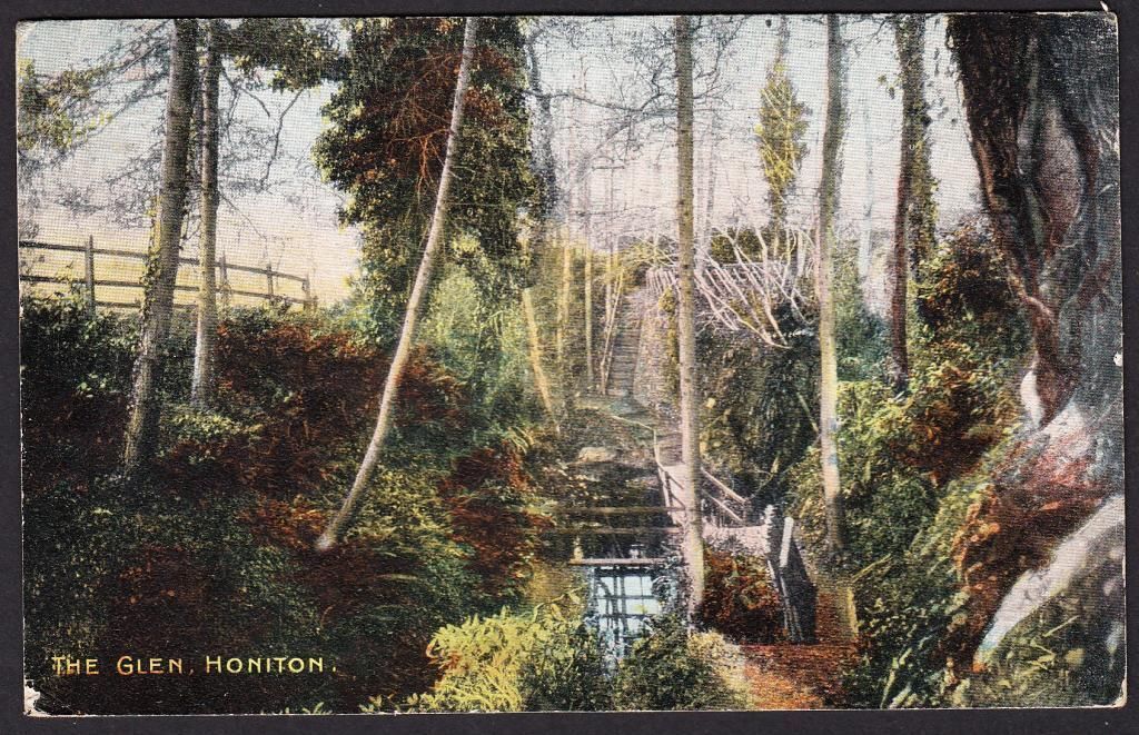
A picture postcard of the part of the Higher Glen now bridged by Waterleat Avenue from when the Ashley family permitted access by 'inhabitants, visitors and invalids'
The lease of both parts of The Glen was offered to the Borough Council in 1908 by the Ashley family but their offer was declined. This description of The Glen had been published the previous year in Mates' Illustrated Honiton: its History Past and Present:
'... the neighbourhood is especially well favoured for lovely walks and drives and no prettier spot can be found than the Glen, a veritable dream of rustic bridges, flowers and foliage.'
By 1935 the two parts were separately owned and were referred to as being by then a neglected but fine example of a 'wild garden'; wild gardens were a type of garden design first popularised by William Robinson in 1870. The same report in the Express and Echo in 1935 mentioned:
'The Glen, a pleasance of singular beauty made by loving care by past owners... at intervals the stream is spanned by rustic bridges, and dammed to form waterfalls... Banks of rhododendrons blaze in their season beneath towering firs. There were footpaths along the winding stream, but these have for some years been lost in a tangle of undergrowth that has been allowed, by neglect, to take undisputed possession of the Glen; while the stream is now a mere trickle, the bed having been allowed to silt up.'
The donor of The Lower Glen, Major Lilley, mentioned during the official opening that he hoped The Higher Glen could also be taken into public ownership and indeed he left a legacy with a time limit, now expired, to help achieve that aim; negotiations to acquire The Higher Glen as part of the Silver Jubilee commemoration in 1935 had been unsuccessful.
Storm damage and continuing neglect, including failure to replace fallen trees, prompted Honiton Town Council to unsuccessfully attempt to acquire The Higher Glen in about 1990. Controversial plans to develop Glen Farm included a road on an embankment across The Higher Glen. Detailed plans by Wilson Connolly plc (Wilcon Homes) again drew attention to the derelict water garden which the Town Council recommended should be protected to allow future restoration. The Secretary of Devon Gardens Trust, following a visit in 1998, recommended restoration of the water garden; that evaluation took place prior to any of the old picture postcards and other views being found. The first of the rediscovered postcards was displayed at Honiton Library when proposals for the Honiton Millennium Green, on land adjoining the Higher Glen, were being exhibited.
East Devon District Council and the Environment Agency, as well as the Town Council, favoured restoration and a survey of local residents in 1999 revealed considerable support as well. Wilcon Homes amended the original outline plan so that the new road would cross The Higher Glen by means of a bridge rather than by a much more damaging embankment. The district and town councils jointly funded a conservation management plan for The Higher Glen in 2003-2004.
The District Council announced in 2003 that the range of trees and other plants in The Lower Glen would be extended and some of the more choice rhododendrons as well as camellias, palms and gunnera were planted in 2003 and 2004.
The main problem identified by The Heritage Lottery Fund in 2008 was the various ownerships of land at The Glen; however this was simplified when The Higher Glen was transferred to the District Council by Taylor Wimpey, the successors of Wilson Connolly (Wilcon Homes), so at last fulfilling Major Lilley's hope expressed in 1937.
During 2009 and 2010 a team from Groundwork South West Trust cleared overgrown laurel from the lowest part of The Higher Glen as far upstream as the Waterleat Avenue bridge. Unfortunately the Coalition Government ceased funding the Trust before the section between the bridge and Lake Close could be cleared. Similarly a team from St. Loyes Gardening Services working on creating or restoring a path along the south west side of The Higher Glen had funding withdrawn by the same Government.
Copyright Honiton Glen Conservation Group (The Friends of The Glen) 2013-2024.